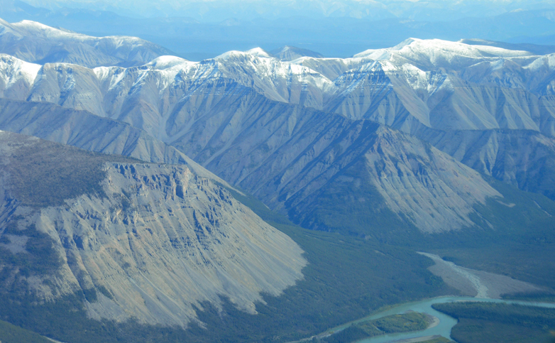
South Nahanni River
Credit: Larry Innes
Parks Canada is currently reviewing how much of the South Nahanni watershed to protect as part of its National Park Reserve system, and they want your help. The area under consideration, named Nááts´ihch´oh National Park Reserve, would lie adjacent to the north of the current Nahanni National Park Reserve. You might recall in June the federal government dramatically expanded Nahanni National Park Reserve from 5,000 square kilometers to 30,000 square kilometers (about half the size of Maine).
For context, here's a map of the entire Nahanni watershed, including the newly expanded Nahanni National Park Reserve and the Nááts´ihch´oh National Park Reserve to its north. Size comparisons to Nova Scotia and Maine were included to show how truly large this region is:

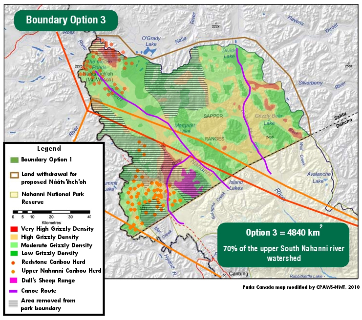
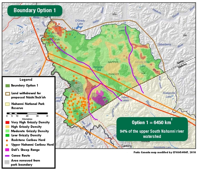
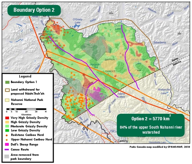
The yellow region is the area where Parks Canada is weighing three options for protection boundaries. This is where you come in. Parks Canada is asking for public comment as to which final boundary they should decide on: one option protects 94%; the second protects 84%; and the third protects only 70% of the region, leaving the remaining 30% open to mining and other industry.
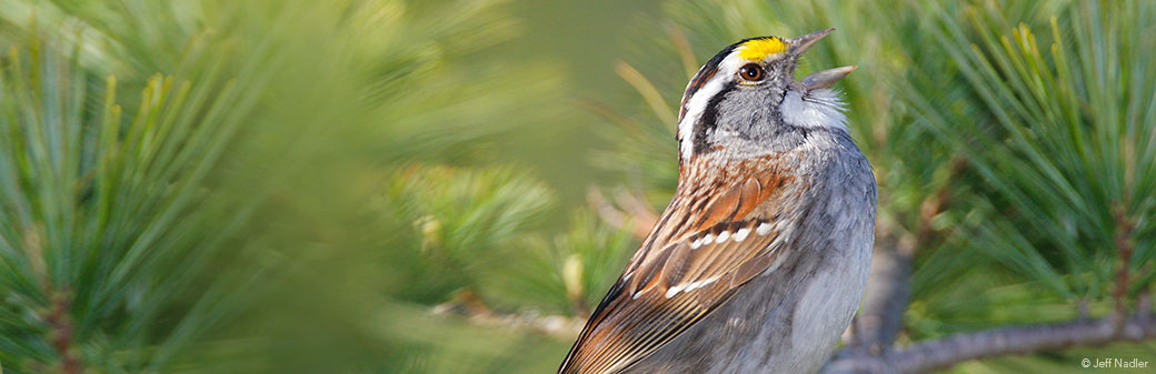
This region is of tremendous cultural importance for the Sahtu Dene, who have lived in the region and practiced traditional land uses for thousands of years. In addition, the region supports critical numbers of caribou, grizzly bears, as well numerous bird species such as the Spruce Grouse, Common Nighthawk, Olive-sided Flycatcher, Townsend’s Solitaire, Gray Jay, Tennessee Warbler, American Tree Sparrow, Lincoln’s Sparrow, Rusty Blackbird, and the White-winged Crossbill.

Olive-sided Flycatcher
Credit: Jeff Nadler
While we would ideally hope for 100% of the region to be protected, we support the first option (which protects the largest percentage at 94%) as the best of the three. In addition to holding meetings with interested parties and stakeholders, Parks Canada is looking to the public to provide comment on which of the three options they prefer. Due to the size and ecological as well as cultural significance of the region, I highly encourage you to submit a comment form to Parks Canada recommending the first option. It's a PDF, so you can either print it out and mail it in or print it out and scan a copy to email to them (where to send it listed on the form).
Submit comment form recommending Option 1 >
You will notice that on the second page they ask you to draw a map of where you think the boundaries should be. Since I would like to see the entire watershed protected, I just drew a line around the outside of the entire watershed.
Here are the three proposed boundaries, which include key wildlife ranges and densities (courtesy of Canadian Parks and Wilderness Society):
Option 1:
Option 2:
Option 3: